

Mapping & Modeling with Drones
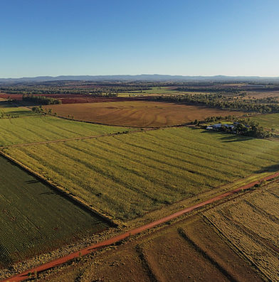
Maximize your land’s potential with drone mapping and modeling, transforming agriculture and land management. Our drones capture high-resolution imagery, 3D models and area & volumetric calculations, providing accurate data on crop health, soil conditions, elevation, and drainage. With real-time insights, you can optimize planting, improve irrigation, and detect issues like erosion or disease early. Particularly important in the South Burnett, we cover large areas quickly and cost-effectively. Drone technology delivers the data you need to boost productivity and sustainability across farms, bushland, and natural landscapes. Smarter decisions start with better data.
OUR MAPPING & MODELING EXPERTS
Unlock the ability to identify project requirements, overlay site drawings, and measure area, volumes or crop yields. Our Drone Mapping & Modeling experts can provide
-
PhotogrammOrthomosaic (see detail below)
-
Digital Elevation Models (DEM)
-
2D & 3D Maps/Models
-
Point Cloud
-
Area and Volumetric Calculations
-
Crop Analysis and Yield Calculations
-
Damage Reports
-
Plant Health
-
Weed Detection
Plus much more, call out friendly team to discuss your mapping and modeling needs.

ORTHOMOSAIC - LANTANA TRACKING
Unlock the power of precision agriculture with Drone PhotogrammOrthomosaic technology. Our high-resolution aerial imaging delivers accurate, up-to-date maps of your paddocks, enabling you to monitor crop health, detect pests or diseases early, and optimize irrigation and fertilization strategies. With centimeter-level accuracy, you gain detailed insights into soil conditions, plant growth patterns, and yield potential — all in real time. Save time, reduce costs, and increase yields by making informed decisions based on clear, comprehensive data. PhotogrammOrthomosaic mapping is your key to smarter, more profitable farming.
DIGITAL ELEVATION MAPPING
Transform your farm management with Drone Digital Elevation Mapping, a cutting-edge tool that provides precise topographic data for smarter agricultural planning. Using advanced drone technology, we create accurate elevation models that reveal natural drainage patterns, soil erosion risks, and low-lying areas prone to flooding. With this data, you can design efficient irrigation systems, reduce water waste, and enhance soil conservation strategies. Digital elevation mapping also supports better land leveling, improving planting and harvesting efficiency. Whether optimizing crop layout or planning new infrastructure, drone elevation mapping gives you the insights needed to maximize productivity and sustainability across your entire operation.

INTERACTIVE MAPPING
Give it a go! This map is the typical workflow for the use of our Drone Spraying and Seeding services. Use the Icons on the left of the image to explore different mapping and view and zoom options. The icon in the top right of the map will let you experience Digital Elevation Mapping (DEM).